[:it]
Obiettivi
Il WP è focalizzato sull’analisi dei dataset esistenti e sulla costruzione di un geodatabase GIS mediante la raccolta di nuovi dati da letteratura, giornali e fonti web. In particolare attraverso la ricerca sul web, che consente di effettuare ricerche mirate, giorno per giorno, sulle parole chiave più rilevanti (caduta massi, frana, crollo, masso).
Risultati
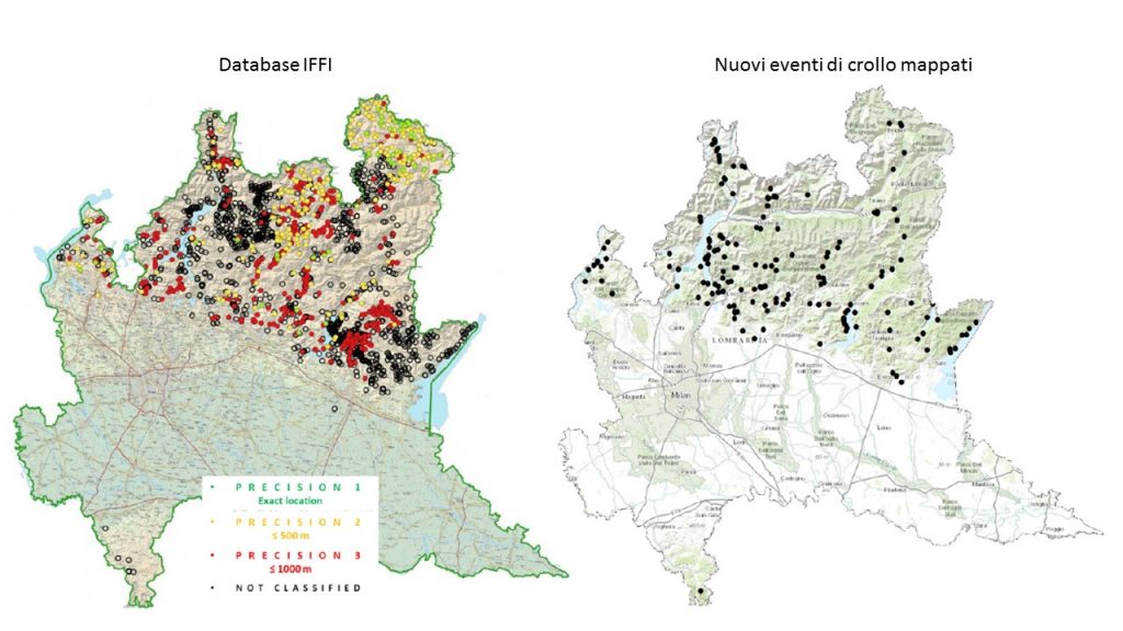
Il database delle frane è stato costruito partendo dal catalogo IFFI prodotto dall’Università di Milano Bicocca a partire dal 2001, nel quale sono registrati 1300 eventi di crollo.
Al fine di aggiornare e completare il database della Regione Lombardia, sono stati identificati circa 350 eventi storici di caduta massi (dal 1961 al 2018) basati su fonti di dati bibliografici e di archivio. È stato quindi creato un nuovo database per i crolli storici, con informazioni dettagliate su: posizione del distacco (con coordinate relative del distaccamento o del punto di arresto e il loro grado di precisione), comune, provincia, data, ora, volume, numero di morti, numero di feriti ed evacuati, tipo di danno infrastrutturale (funzionale, strutturale o estetico) e fonte di informazione.
Azioni in corso
Per l’intera durata del progetto si continua a tenere aggiornato il database. Alla fine del progetto, i dati acquisiti saranno trasferiti a Regione Lombardia per l’implementazione del database GeoIFFI.
[:en]
Objectives
The WP is focused on the analysis of existing datasets and construction of a GIS geodatabase by collection of new data from scientific technical literature, newspapers, web sources. In particular, Google Search allows to make focused searches, day by day, on the most relevant keywords (rockfall, landslide, “frana”, “crollo”, “masso”).
Results
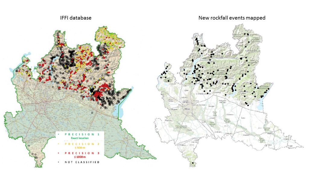
The geodatabase of landslides is created starting from the IFFI catalog produced by the University of Milan Bicocca starting from 2001. The inventory includes 1300 events of rockfall.
In order to update and complete the IFFI database, approximately 350 historical rockfall events (from 1961 to 2018) based on bibliographic and archive data sources were identified.A new database is created with detailed information on: location of the posting (with relative coordinates of the detachment or stopping point and their degree of precision), municipality, province, date, time, volume, number of deaths, number of injured and evacuated, type of infrastructural damage (functional, structural or aesthetic) and source of information.

On going research
For the duration of the project the database will be updated. At the end of the project, the data acquired will be transferred to the Lombardy Region for the implementation of the GeoIFFI database.
