[:it]Rockfall Hazard and Risk zonation at the Regional Scale
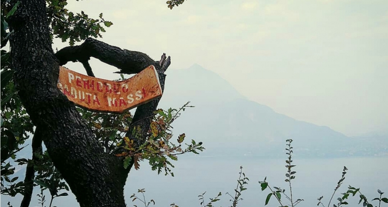
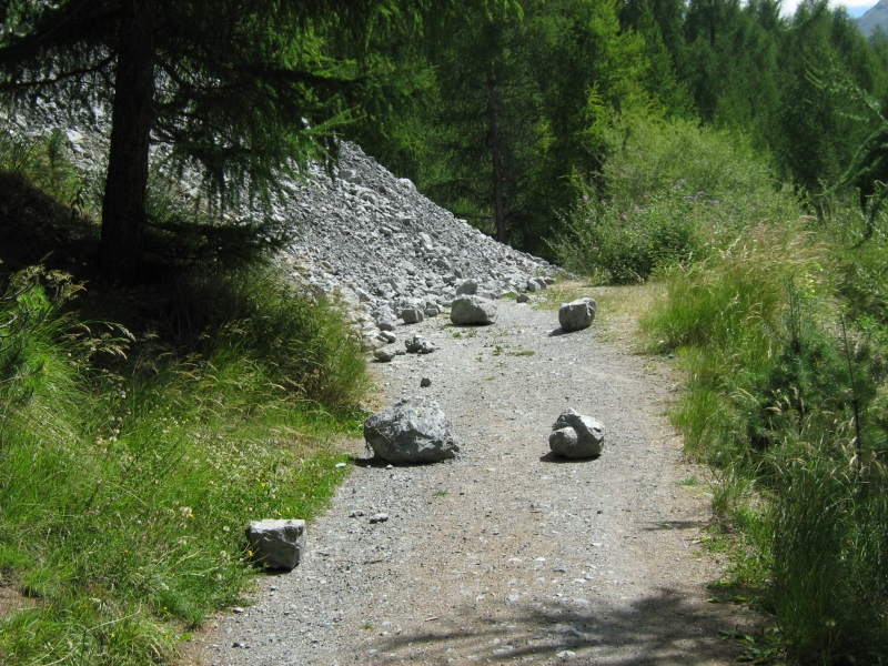
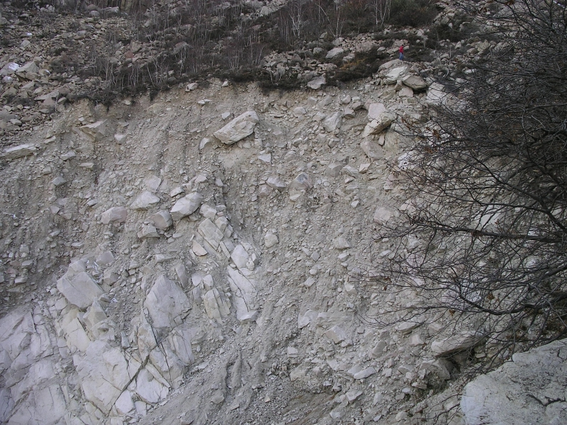
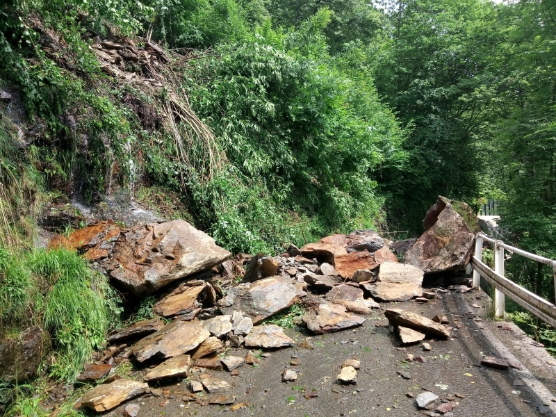
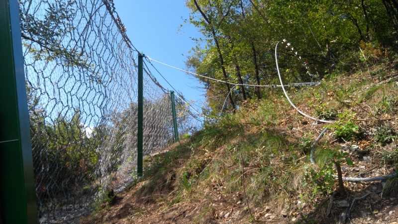
Le frane di crollo coinvolgono volumi di roccia che si muovono per caduta libera, rimbalzo, rotolamento e scivolamento ( Cruden e Varnes, 1996 ). Questa tipologia di frane è estremamente frequente nell’area alpina e in Lombardia in particolare. In generale, i cicli di gelo e disgelo, le precipitazioni e gli scuotimenti sismici sono tra i fattori scatenanti più frequentemente riconosciuti,; oltre a questi sono individuati dei fattori secondari quali la crescita delle radici, l’effetto dei venti forti o l’invecchiamento progressivo delle masse rocciose. Dagli anni ’90 è stato registrato un aumento progressivo del numero di crolli ( < 100.000 m3 ) a quote medio-alte, in relazione diretta con le precipitazioni e la temperatura media annuale. Gli scenari climatici futuri ( CH2011, 2011 ) includono: periodi di scioglimento rapido della neve, precipitazioni anticipate alla fine dell’inverno ( tra + 3,6% e + 10,4% ), diminuzione delle precipitazioni in estate ( tra -4% e -20,4% ) e aumento delle temperature. Tutti questi fattori sono e saranno rilevanti nell’innesco di frane in diversi ambienti che possono coinvolgere elementi quali strutture, infrastrutture, linee di vita e località turistiche. Si prevede che la frequenza di questi eventi aumenterà e che le dimensioni delle cadute saranno correlate con i cambiamenti climatici. Il rischio legato a frane di crollo è gestito da Regione Lombardia attraverso opere di pianificazione territoriale, contromisure di protezione e azioni di protezione civile. Le azioni di protezione richiedono la caratterizzazione del rischio legato a frane di crollo per diversi scenari, che tengano conto della distribuzione spaziale, della frequenza e dell’intensità degli impatti, della vulnerabilità degli elementi esposti e dei costi previsti, per un’analisi costo-efficienza delle opere di mitigazione. Il problema delle frane è gestito principalmente attraverso valutazioni di suscettibilità e pericolosità ( Crosta e Agliardi, 2003; Jaboyedoff et al., 2005 ) o contromisure ingegnerizzate ( Ritchie, 1963; Nichol and Watters, 1983; Calvetti e Di Prisco, 2009; Volkwein et al., 2009 ). La pericolosità legata ai crolli è la probabilità che un punto specifico venga raggiunto da frammenti di roccia con una particolare intensità ( Crosta e Agliardi, 2003; Jaboyedoff et al., 2005 ). Pertanto, questa probabilità è una combinazione di probabilità di innesco ( cioè la probabilità che avvenga un crollo ) e probabilità di propagazione ( cioè la probabilità che i blocchi raggiungano un punto specifico ).
Obiettivi
L’ obiettivo principale del progetto è lo sviluppo delle conoscenze scientifiche nell’ambito dello studio delle frane di crollo, al fine di produrre degli strumenti di valutazione della pericolosità e rischio. Lo scopo sarà raggiunto attraverso l’utilizzo di tutti i set di dati ufficiali disponibili in formato GIS ( standard INSPIRE ) e fornendo queste conoscenze alle autorità regionali e municipali, agli operatori delle infrastrutture, ai professionisti e alla comunità, al fine di rafforzare le strategie di gestione del rischio e di resilienza sociale.
Gli obiettivi del progetto sono:
- lo studio della relazione tra gli elementi scatenanti e l’innesco, specialmente in ambienti caratterizzati dall’interazione tra da diversi fattori
- lo studio degli effetti dei cambiamenti climatici sull’innesco di frane nelle aree prealpine e alpine, come conseguenza dell’aumento della temperatura, dei cambiamenti delle precipitazioni e della degradazione del permafrost;
- l’implementazione di uno strumento affidabile e scientificamente valido per la modellazione 3D a scala locale e regionale, per essere facilmente utilizzato dalle agenzie regionali;
- lo studio del ruolo della caduta di massi nella produzione di detriti all’interno della rete di drenaggio, che potrebbe portare ad un drastico aumento del rischio di debris flow durante gli intensi eventi di pioggia.
Metodi
La realizzazione del progetto sarà effettuata dall’Università Milano Bicocca e dal Politecnico di Milano. Il progetto è strutturato in 6 azioni ( WP, work-packages ) modulate secondo le seguenti fasi:
- WP1: creazione di un geodatabase di eventi scatenanti e eventi di frana in Lombardia ed aree confinanti
- WP2: studio della relazione tra fattori d’innesco e condizioni meteoclimatiche che possono portare a dei crolli
- WP3: implementazione del codice Hy-STONE con nuove leggi sull’impatto e sviluppo di uno strumento di modellazione dedicato per le autorità regionali
- WP4: valutazione della pericolosità e del rischio per l’intera Regione Lombardia
- WP5: sviluppo dei futuri scenari di pericolosità e rischio
- WP6: divulgazione della metodologia e dei risultati del progetto alla pubblica amministrazione, tecnici, professionisti ed alla comunità
 [:en] Rockfall Hazard and Risk zonation at the Regional Scale
Rockfalls involve volumes moving by free falling, bouncing, rolling, and sliding ( Cruden and Varnes, 1996 ). They are extremely frequent and have a long runout. In general, freeze and thaw cycles, rainfall and seismic shaking are among the most frequently recognized triggering, but also root growth or leverage in high winds, or progressive weathering of rock masses can cause detachments. Rockfalls are extremely important in alpine area and in Lombardy in particular. Since 1990s, a progressive increase in the number of rockfalls ( < 100.000m3) has been recorded at mid to high elevations in direct relation with rainfall and mean annual temperature. Future climate scenarios ( CH2011, 2011 ) include: rapid snowmelt periods, anticipated rainfall at the end of winter ( between +3.6% and +10.4% ), rainfall decrease in summer ( between -4% and -20.4% ) and increase in maximum temperatures. All these factors are and will be relevant at triggering rockfalls in different environments, endangering structures, infrastructures and lifelines, and most of the touristic resorts and structures at mid and higher elevations. It is expected that these changes will increase the frequency of events and that larger meteo-climatic changes will be related with the size of the rockfalls. Rockfall risk is managed in Regione Lombardia through land planning, protection countermeasures, and civil protection actions. Protection from rockfalls requires the characterization of rockfall hazard for different scenarios, spatial distribution, frequency and intensity of impacts, vulnerability of exposed elements, expected costs, and a cost-efficiency analysis of mitigation options. In real practice, rockfall problem is mainly managed through susceptibility-hazard assessments ( Crosta and Agliardi, 2003; Jaboyedoff et al., 2005 ) or engineered countermeasures ( Ritchie, 1963; Nichol and Watters, 1983; Calvetti and Di Prisco, 2009; Volkwein et al., 2009 ). Rockfall hazard is the probability that a specific location will be reached by rock fragments with a particular intensity ( Crosta and Agliardi, 2003; Jaboyedoff et al., 2005 ). Therefore, this probability is a combination of onset probability ( i.e. the probability of rockfall occurrence ) and runout probability ( i.e. the probability that falling blocks will reach specific locations ).
Objectives
The main concept of the project is to develop the highest scientific knowledge for rockfall, to prepare valuable products by using all available official datasets in GIS format ( INSPIRE standards ) and to provide this knowledge to regional and municipal authorities, infrastructure operators, professional, and the civil society in general for strengthening risk management strategies and social resilience.
The scientific aims of the project are:
- to explore the relationship between triggering events and rockfall onset, especially in environments characterized by different interacting factors
- to study the effects of climate change on rockfall activity in prealpine and alpine areas as a consequence of temperature rise, rainfall pattern changes and permafrost degradation;
- to implement a reliable and scientifically sound tool for 3D rock fall modelling at a local and regional scale to be readily used by regional agencies;
- to study the role of rockfall for debris production within stream network, possibly leading to a drastic increase in debris flow hazard during intense rainfall events.
Methodology
The implementation of the project will be done by the two partners in strict collaboration by using the facilities available at UNIMIB and POLIMI. The project is structured on 6 actions ( WP, work-packages ) modulated according to the following phases:
- WP1: creation of a geodatabase of triggering events and rockfall events in Lombardy and conterminous areas
- WP2: study of the relationship among triggering events and meteoclimatic conditions and the onset of rockfalls
- WP3: implementation of the Hy-STONE code with new impact laws and to develop a dedicated modelling tool for regional authorities
- WP4: assessment rockfall hazard and risk for the entire Regione Lombardia
- WP5: development of future scenario of rockfall hazard and risk
- WP6: dissemination of the methodology and results of the project to stakeholders, policy-makers, technicians, professionals, civil society.
[:]